Saturday, March 5, 2011

Exploring South Manitou Island Part II

Well let's lace our hiking boots back up and continue our journey across South Manitou island.  I left off last time as I made my way through the virgin grove of Northern White Cedars (Thuja occidentalis) known as the Valley of the Giants on the southwest corner of the island.  The first post was spent almost entirely in the fertile, moist hardwood forest that graces most of the islands surface but be prepared to enter a completely different world on this second stage of the journey.  This time we are starting on the western edge where the trees stop and all you can see is the beige colored sand of the perched dunes of South Manitou Island.

When hiking through the Valley of the Giants you will notice as you get to the rear of the grove that it is backed up against a huge, tall wall of sand that climbs steeply to a height over the canopy of the forest.  This is the trailing end of the perched dunes that run along the west side of South Manitou.  Getting to the top will get the blood flowing and make your calves feel as if they were on fire but trust me when I say it's all worth it in the end.  Many biologists and geologists agree that these dunes are one of the best examples of this type to be found in the country and should be preserved at all costs.  Perched dunes are rare globally because they only exist under the right geomorphilogical conditions. Thousands of years ago glaciers carved out the enormous basins of the world-famous Great Lakes.  As the glaciers moved they sliced out a ridge of limestone along the area that is now the north-eastern section of Lake Michigan.  As the climate warmed and the glaciers slowly shrank back and receded to the north, the huge basins filled with melt water and the tops of these ridges were exposed as a chain of islands that exist to this day.  South Manitou starts off the chain of islands which extend northeasterly across Lake Michigan and include the islands of North Manitou, the Fox Islands, Beaver Island, all the way to the famous Island of Mackinac.  Over the course of thousands of years the westerly winds have carried sand up onto the steep cliffs and bluffs of South Manitou, depositing their loads and creating the perched dunes you see today.  North Manitou and some of the other islands show good examples of this type of dune environment but none can touch the quality, size and naturalness of South Manitou's.

Sweeping dunes atop the western edge of South Manitou Island
 
The above picture shows the drastic change in environment as you move upward across the eastern edge of the perched dunes and come up out of the "lush" hardwood forest from below.  Not only does the scenery change abruptly but so does the vegetation type and plant species.   The switch from plants that appreciate the rich, moist soils of the northern forest to species that are more accustomed to living and surviving in harsh, desert-like conditions is like stepping from a dark room into daylight.  Dune vegetation, most specifically the grasses, play a vitally important roll in keeping the health of the dune ecosystem at a max.  A few of the most common grasses found on the dunes are Prairie sandreed (Calamovilfa longifolia), American beachgrass (Ammophila breviligulata) and Prairie Junegrass (Koeleria macrantha), the last two being state-listed in Ohio.  Without the root systems of these plants the wind and rain would quickly diminish the quality and structure of these rare and ecologically important areas.  The picture from above shows off some of the more common species of plants found on the dunes.  The large, shrubby bush in the center is Buffaloberry (Shepherida canadensis) while the darker green shrubs in the background are Common Juniper (Juniperus communis).  The green, prickly plant seen covering most of the sand is another Juniperus species, the Creeping Juniper (Juniperus horizontalis).  If you click the photo to see a larger version you will notice small pockets of a yellow flowering plant; this is Hoary Puccoon (Lithospermum caroliniense) which is a threatened species in Ohio only being found in select areas on the dunes of Lake Erie.  Even more challenging to see just behind the Buffaloberry are the orange blooms of another threatened Ohio species, Wood Lily (Lilium philadelphium).  Like I mentioned before, this island and area of Michigan is full of species found commonly up here but very local and rare in our state.

Looking back across the island at the bay
 
As you get higher towards the 'top' of the island you start to realize the amazing 360 degree panoramic view you have of the mainland and surrounding Lake Michigan.  You can now get a good look at where you've been, where you are going and just an overall grip on the size of the island and it's noticeable landmarks.  Above is a shot looking northeast across the island.  Just barely seen jutting out into the water is the northern arm of South Manitou that helps create the natural bay discussed in the first post.  This is hardly the only important service it provides to the island.  The tip of this peninsula is called 'Gull Point' and is a critical breeding area for the highly endangered Piping Plover.  According to the Michigan DNR there are as few as 30 mating pairs in the Great Lakes and a few are known to use South Manitou as a vital nesting ground.  North Manitou (the landmass in the background of the above photograph) also has known nesting grounds for the Federally threatened Piping Plover.

The federally threatened Pitcher's Thistle (Cirsium pitcheri)
 
Speaking of Federally threatened species, this is the likewise Pitcher's Thistle (Cirsium pitcheri).  Only found in four Great Lake states growing directly on the dunes along the shore, this plant is quickly losing its already limited habitat.  For those who are my faithful and devoted readers (and I sincerely thank you for those that are) you will remember I did a separate post about this plant here.  If you are interested in learning more about this plant I highly suggest taking a look at that post if you haven't already.  Another rare and state threatened species frequently found on the dunes is Clustered Broom-rape (Orobanche fasciculata).  It is parasitic to the roots of other plants in the Asteraceae family but only found growing on Wormwood (Artemesia caudata) on South Manitou.

Looking back at the mainland and the Sleeping Bear Dunes
 
Looking back southeast across the canopy of the forests to the mainland you can see the Sleeping Bear Dunes on the right.  Larger (in height and area) than the dunes of South Manitou they were formed in the same manner as described earlier.  These dunes are not nearly as pure and unspoiled as South Manitou's due to heavy foot traffic by tourists and hikers.  Right on the shore, near popular summer vacation spots, these dunes see thousands of visitors a year that put millions of footprints in the sand deteriorating the structure and vegetation with each step.  While South Manitou get's its fair share of visitors each summer, the very large majority are day hikers and do not spend more than the allotted 5 hours on the island before the ferry leaves.  The hike to the Valley of the Giants alone is a six mile round trip so very few people have time to see the dunes and even less time to explore them.  That has been the fortunate secret to keeping South Manitou's as high quality and pristine as possible.

Harebell (Campanula rotundifolia) growing on the dunes
 
These beautiful and delicate purplish-blue flowers are found all over the dunes, especially as you get higher towards the apex at the edges of the bluffs.  This plant is known as Harebell (Campanula rotundifolia) and while found all over Michigan it is very rare in Ohio.  Oddly enough one of the only known populations in Ohio is in my home county of Miami, growing on the cliff sides along the Greenville Falls near Covington.

The western dune bluffs of South Manitou Island
 
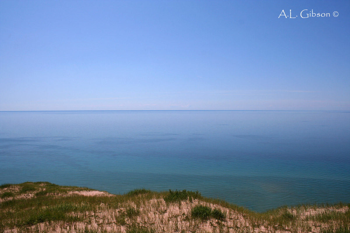
This is one of my favorite views from one of the highest points on the island.  Looking directly west across the crystal waters of Lake Michigan you can almost see the curvature of the Earth on the horizon.  While spending so much time in the darkened and shaded forest it feels like you are on a different world on top of the island.  An arid desert is stretched out before you with nothing but sand, wind and skeletons of ancient cedars long lost to the ever moving sand dunes.  Don't let the distance fool you, it's a healthy mile to the edge of the island from the vantage point in this photograph.

Ancient, bleached skeletons of White Cedar trees long forgotten

 Scattered throughout the perched dunes are sun-bleached skeleton cedar trees that have been weathered and sand blasted to a natural smoothness that feels unique to the touch.  Perched dunes are by no means a static environment.  The winds are ever shifting their positions, extending and diminishing their ranges.  Hundreds of years ago as the dunes shifted, these live and thriving cedars were swallowed by the oncoming dunes only to be excavated by the winds centuries later to stand as relics of their once great empire.

White Wand-lily
Dead cedars clinging to the bluffs


A former stand of White Cedars clinging to the cliff face of the dunes makes for an impressive sight.  The ever shifting positions of the dunes can expose old soil layers which can give researchers an inside look at the history of the previous vegetation.  One of the most interesting plants, least in my opinion, on the island was the large presence of  White Wand-lily (Zigadenus glaucus), which is pictured above.  Also known as White Camas or Death Camas, this plant was found growing all over the dry, sandy dunes along the high bluffs of the island.  This is considered a potentially threatened species in Ohio and is found growing most commonly in fens, which is the only place I've ever seen it in our state.  On South Manitou it was growing in a completely different type of environment all together, not to mention in greater and healthier numbers.  Interesting how this plant can be found in such varying habitats in different areas of the country.

What a view!
 
On a day with perfect climatic conditions it is possible to see the eastern shores of Wisconsin, nearly 50 miles away from the top of the island.  While it was a clear and sunny day when I found myself peering westward the atmosphere was too humid and the air had a hazy mist to it on the horizon, preventing me from seeing all the way across the Great Lake.

Western edge of the island
Sand dune bluffs


Standing at the very edge of the bluffs looking to the north and south shows just how high up and steep the perched dunes are.  About 400 feet above Lake Michigan and slopes approaching 30 degrees, these gigantic piles of sand are nothing to mess around with.  Getting down is one thing, but getting back up is a lot more of a challenge than these pictures portray.  You can see how the winds coming in from the west would hit these walls of sand and limestone and push the loose sand up and over the ridge and slowly fill in the island.  While the east side of the island is a deep watered and sheltered bay, the west side is open to all attacks by the elements.  Looking from the shore out into the lake you can see how shallow the water is further out in the lake as the sand gets blown in closer and closer to the perched dunes. 

Northern shore of the island facing N. Manitou Island
 
At the northern end of the island I decided to climb down to the lakeshore and follow its edge until I picked up a trail heading down the center of the island that would eventually get me to my campsite for the night, which was all the way down on the southern end at the Weather Station Campground.  Much like the eastern shoreline of the island, the north is gently sloped right down to the water with the coastal forest starting about 25 yards inland.  The land you see on the horizon is the upper half of North Manitou.  You can see the perched dunes of the neighboring island rising up from the lake.

An American Toad nestled amongst the sand and shells on the beach
 
While sitting on the shore soaking my tired feet in the chilly waters I noticed this little guy nestled amongst the sand and shells on the beach.  American Toads (Bufo americanus) are a common occurrence on the island and provide many a meal for the equally numerous Garter Snakes that abound.  Unfortunately on my walk through the interior of the island down to my campground provided little opportunities for photographs.  Honestly, it was most likely my exhausted feet and sore back from carrying my 40+ pound backpack with all my camping gear over 10 miles across some hilly ground and the fact I ran out of water halfway across the perched dunes.  Not a very fun area to run out of water!  Once I reached the campground at Weather Station I set my tent up in-between two ancient Beech trees and cooked myself dinner with a beautiful view across the lake back at the mainland.  A refreshing swim followed with a relaxing layout on the beach hit the spot as I watched the sailboats glide through the waters.  I looked back at the mainland and wondered what delicious restaurant my parents decided to eat at.  I assume it was better than what I mustered up earlier but I can safely say they couldn't beat my view.  

South Manitou lighthouse
Lighthouse


I awoke early the next morning to the sound of American Redstarts just warbling away in the Beech trees above me.  Wish I could wake up to that kind of alarm clock more often.  I decided to keep to the shore and make my way back to the lighthouse and dock to check in when the ferry arrived.  The 100 foot tall lighthouse was built in 1871.  Its powerful light had a range of 17 miles and guided countless ships safely through the Manitou Passage until its retirement by the Coast Guard in 1958.  

The deep and sheltered bay of South Manitou
 
After arriving back at the dock I decided to relax for the afternoon while the day crowd explored the island.  I took a leisurely walk along the shoreline of the bay and after finding myself quite alone, stripped down to my skivvies and took a long dip in the bay.  Few things are as purely refreshing and cleansing as swimming in Lake Michigan.  Even during the hot summers the water temperature never makes it out of the 60's, making for quite the chilled swim even in the middle of July.  A few hours later I was once again on the ferry making my way back to Leland and to civilization.  I will leave you with a photograph of one of northern Michigan's famous sunsets with South Manitou Island on the horizon, soaking in the waning oranges and reds of the setting sun.  Thanks for reading and I hope you enjoyed my journey across one of Michigan's greatest natural treasures!  I cannot wait to go back!

Perfect northern Michigan sunset


Thursday, March 3, 2011

Exploring South Manitou Island Part I

 *Be sure to check out part two of this series by clicking RIGHT HERE!*

An ancient Chippewa Indian legend tells the tale of how the Manitou Islands came to be.  The story goes that a mother bear fled from a great forest fire in Wisconsin with her two cubs and swam across Lake Michigan to the Michigan shore for safety.  Upon reaching the shore the mother climbed a steep bluff to await her cubs arrival.  The cubs, exhausted from their long swim, were lost to the great lake and never made it ashore.  Filled with grief the mother bear waited day after day for the cubs on the steep bluff until her final breath.  The Great Spirit Manitou marked her final resting place with the Sleeping Bear Dunes and raised North and South Manitou Island from the depths of Lake Michigan in remembrance of where the two cubs perished.  Today these geological wonders still stand where the Great Spirit placed them for generations of people to come and experience the beauty and wonder of northern Michigan.
 
Located about ten miles offshore from Glen Arbor in Leelanau County, Michigan sits South Manitou Island in the chilled aqua waters of Lake Michigan.  If you are curious where exactly in Michigan this area is located here is an easy way to give you a good idea where to look on a map.  Stick out your left hand with your palm facing out.  Kinda looks like the outline of the state, right?  Focus on your pinkie fingernail, that is Leelanau County and just off the left side of the tip of your pinkie are the Manitou Islands.  Sure, you could have just jumped on Google maps and typed it in but I think my way is more fun and original.  Only a bit over 8 square miles in area, what this island lacks in size is more than made up for with its natural history and long list of incredible sights.  As mentioned in my earlier post on the Pitcher's Thistle, Leelanau County is one of my favorite summer memories from my childhood and even now as an adult.  A couple summers ago I spent two days and a night backpacking and exploring this remarkable environmental gem and would like to take you back there with me to get a first hand look at just how unique a place this is.  So make yourself comfortable and enjoy the pictures and journey this post takes you on.  Here we go!

Map courtesy of the Sleeping Bear Dunes National Lakeshore (U.S. NPS)
 
Above is a map to reference whenever I talk about a specific part of the island (don't forget to click on the pictures to see them in bigger, greater detail).

North Manitou Shoal Lighthouse
 
 An hour and a half long ferry ride from Leland, Michigan is the only way to get to the island if you do not have a capable boat of your own.  The ferry is loud and slow but with the lake breeze and warmth of the morning sun on your face along with the sights make for a bearable trip out.  Pictured above is the North Manitou Shoal Lighthouse with our destination the blob of land on the left.  Built in 1935 to help ships make the perilous voyage through the Manitou Passage safely, it now sits in solitude as a roost for numerous Gulls, Cormorants and Terns.  The Manitou Passage has long been considered one of the most dangerous areas in all of the Great Lakes.  There are over 50 known shipwreck sites in the area around the Manitous and many are popular diving spots.  As you can see from the map above the eastern side of the island curves to form the best natural bay and harbor to be found in-between Chicago and the Straits of Mackinac.  Many a ship was saved during the 19th and 20th centuries from the violent and deadly storms Lake Michigan is fabled for.

*Note*  Since this trip was made over two years ago and I never planned on writing a travel blog for it I will do my best to use what pictures I took to the best of their advantage.  If I could do it all over again I would take much more specific photographs of the different areas and features of the island to better show off what I'm talking about.

So with that said let's take our first steps into the wilderness.  I started off walking along the southern edge of the island in a general westerly direction.  This course takes you through the woods all the way to the perched dunes at the western edge of the island.   In the mid-1800's South Manitou's forests fueled the boilers for the hundreds of steamships that sailed through the area.  This heavy logging caused the island's virigin forest to be all but gone before the turn of the century in 1900.  Only a small area in the southwestern corner was never touched, but we will get to that later in the post.

American Basswood
White Birch


The island today is covered in a second growth forest that resembles in species make-up the forest that prevailed the settlers.  The flora and forest type of the island falls into the same categories as the rest of the northern Great Lake states with a few exceptions.  Under the Northern Hardwoods banner, South Manitou's forests change subtly in areas and are dominated by American Beech (Fagus grandifolia), Sugar Maple (Acer saccharum) and Eastern Hemlock (Tsuga canadensis) with a strong association of Yellow Birch (Betula alleghaniensis), White Birch (B. papyrifera), Northern White Cedar (Thuja occidentalis), American Basswood (Tilia americana), Ash (Fraxinus spp.) and the occasional Red Oak (Quercus rubra) on the interior of the island.  The coastal areas of the island have many of the aforementioned trees but also contain White Pine (Pinus strobus), Red Pine (Pinus resinosa) and Jack Pine (Pinus banksiana) with many White Birch and Quaking Aspen (Populus tremuloides) mixed in.  With the clearing of the land for cordwood for the steamers came homesteads, farms, livestock fields and orchards for the early settlers.  When the farms failed the land was allowed to succeed back to its current forested state.  Signs of their occupancy can still be seen throughout the island today.  A few houses and barns in varying stages of decay and ruin are scattered amongst the fields and forests.  Also serving as evidence of those who came before are a number of species of non-indigenous plants left to grow on the island.  American Chestnut, Mulberry, Black Walnut, Apple, Cherry and Pear can still be found growing "wild" amongst the native vegetation.

Aralia racemosa
Clintonia borealis


Despite the clearing of the original forests on South Manitou, the island still enjoys a very lush, diverse and rich aray of herbaceous species.  Some of the species many of you from our home state of Ohio would be very familiar with such as;  Large-flowered Trillium (Trillium grandiflorum), Jack-in-the-Pulpit (Arisaema triphyllum), Partridgeberry (Mitchella repens), Wild Leek (Allium triccocum), Canada Violet (Viola canadensis) and Spikenard (Aralia racemosa).  Most however are either not found in our state or are very rare like the species from the picture above; Bluebead-lily (Clintonia borealis), which is an endangered species in Ohio.  Another rare species in Ohio that is commonly found as a ground cover on the island is Canadian Yew (Taxus canadensis).  A few more species found on the island include; Northern Bush-honeysuckle (Diervilla lonicera), Snowberry (Symphoricarpos albus), Red Baneberry (Actaea rubra), Striped Maple (Acer pensylvanicum) and Bunchberry (Cornus canadensis).  I wish I had photographs of these species but there's always next time.  Many of the plants I saw were among the largest I am likely to ever see, especially those of the woody 'shrub' variety such as the three native Aralia species and Canada Yew.  The reason for this is there are no grazing mammals living on the island to eat back and keep all the new growth at bay.  White-tailed Deer were introduced to North Manitou island but never to the South which has caused the degradation to the native ground cover and herbaceous species of the North island.  Many species found on South Manitou are no longer to be found on its larger neighbor due to this unfortunate decision to release the deer several decades ago.

Eastern Garter Snake
 
Perhaps the only reptile on South Manitou Island is the Eastern Garter Snake (Thamnophis sirtalis) and boy are they everywhere.  It seems every couple of steps one would go slithering away into the underbrush.  This one was kind enough to pose for a photograph or two even if he does seem a bit perturbed.  Making your way along the southern edge of South Manitou about half way across the island is the only inland body of water, Lake Florence.

Lake Florence, the islands only interior body of water
 
According to a limnological investigation done by the University of Michigan Biological Station, Florence Lake is only 26 feet deep at its maximum and has an overall mean depth of only 10 feet.  Watermarks around the shores indicate water levels have a tendency to fluctuate.  Due to there being no inlet or outlet sources on the lake and the lake sitting at an elevation lower than that of Lake Michigan, the water level is directly controlled by the water level of Lake Michigan itself.  Another interesting fact about Florence Lake is that despite its relatively small size in area, its watershed drains nearly 50% of the islands land surface (rain/ground water runoff).  Many different species of aquatic plants grow in and along Lake Florence.  Species from the genus' Carex, Scirpus and Potogometon were the most common observed.  

The rusting wreckage of the Francisco Morazan
 
As mentioned earlier, the Manitou Passage is famous for its many shipwrecks spread throughout the area.  The most famous and noticeable of all the wrecks is the 1960 grounding of the Francisco Morazan.  After dropping off cargo and getting reloaded in Chicago, the Francisco Morazan was headed for the Netherlands when on the night of November 29th in a terrible snowstorm it ran aground on a shallow shoal just off the shore of South Manitou.  All of her crew survived and were rescued without much difficulty and the wreckage was left to rust in her shallow, watery grave.

The once prized ship is now just a roost for passing seabirds
 
After leaving the shoreline and the ghostly remains of the Francisco Morazan you are not very far away from entering the most enchanting and memorable section of the island...the Valley of the Giants.  A small, ancient virgin grove of Northern White Cedars on the southwest corner on the island contains some of the oldest and largest of their kind on the planet, including the former national champion.

Virgin White Cedar forest
Ancient White Cedar tree


While these pictures cannot truly give these mammoth and ancient trees the true justice they deserve it can give you but a small taste of one of the rarest ecosystems in the country.  It is believed that the remote location of the grove as well as the proximity to the dunes is what allowed this magnificent masterpiece of nature to survive to this day.  Sand from the dunes forever mixed into the bark and grain on the wood would quickly dull and ruin the loggers saw blades is one hypothesis or perhaps the lumberman didn't have the heart to take down all the mighty monarchs of the forest.  Whatever the reason may be, let us be forever thankful it survived.  With heights reaching 100 feet tall and girths 3-5 feet in diameter, it's not everyday you get to see a forest like this in today's world, let alone one of this type of tree.  

The fallen former national champion White Cedar

On a sad note, here is what remains of what I believe to have been the former national champion Thuja 
occidentalis.  Almost six feet in diameter and nearly 100 feet in height, I wish I could have stood next to this behemoth to give you a size comparison.  The trees of this size in this grove have been aged using a corer to count the growth rings.  The largest ones have been growing for over 500 years!  That's incredible to even think about.  I've seen 500-1,000+ year old trees out in Washington state but to see something like this back east is mind blowing.

Your blogger and a huge Cedar!
Virgin White Cedar forest


I can't wait until I get the chance to get back to this place and really explore this area of the island more.  The 40 acre virgin grove is a very well-mixed aged stand.  There are many seedlings and saplings patiently biding their time to reach the lofty goals of their ancestors as well as many cedars of a more normal size filling in the holes in the canopy.  This time-tested forest is slowly weening itself of its largest members and will one day not have the same visual affect on visitors as it does today.  Several rare and threatened species of plants make their only homes on this island in this secluded grove as well.  Walking Fern (Asplenium rhizophyllum) and Green Spleenwort Fern (Asplenium viride) are both threatened species in Michigan and are both part of very disjunct populations on South Manitou.  Green Spleenwort is not found anywhere in the lower peninsula except for South Manitou while the Walking Fern is found in only two other counties in the L.P. but both populations are well over 100 miles away.  How these ferns got to the island, who knows?  The Large Yellow Lady's Slipper (Cypripedium parviflorum var. pubescens) can also be found in the secluded haunt of the ancient cedars.

I think I have had enough for one post!  Up next is the climb up the perched dunes to the top of the island for one of the best panoramic and beautiful views I've ever seen!  Hope you have enjoyed the first part, I will be sure to post the follow up sometime in the next day or so.


Sunday, February 27, 2011

A Rare Thistle in the Sand

Despite the name of the blog being The Natural Treasures of 'Ohio', I'd like to escape our borders every once in a while for an out of state botanical adventure or two.  As unique and beautiful as Ohio is I think it's important to be well rounded and explore the infinite other areas of interest in our area of the country and beyond. 

Leelanau County, Michigan has been my summer vacation spot literally all my life.  A week or two each summer would be spent fishing the lakes for bass and pike, the cold, spring fed streams for trout, swimming in the chilly waters of Lake Michigan searching for petosky stones and soaking in the sun and beauty of northern Michigan.  I'll always cherish my time up there with my parents and brother and look forward to those days renewed when I may take my future family up there to experience the same magic.  My footprints in the sand along the beach may be quick to wash away but all the memories made are etched in stone in my brain.

As my interest and passion in the botanical world has increased the past few years so has my realization of just how incredibly diverse and unique this area is.  Recently I've been going through some pictures from a couple summers ago when I hiked and camped South Manitou Island.  I plan on doing a post about my experiences on the island and the interesting history and flora that come with it in the near future but I decided to do a quick appetizer of a post on an interesting plant I just now noticed in my picture archives.  I'm not quite sure what got me to photograph this plant three years ago, as I didn't know what it was and it really doesn't stand out in any way but I am very thankful I did.  Little did I know I was photographing and admiring the rare and federally, yes that's right, federally threatened Pitcher's Thistle (Cirsium pitcheri).

Typical habitat for the federally threatened Pitcher's Thistle
 
Also known as Dune Thistle, C. pitcheri can only be found growing along the shores and dunes of the Great Lakes in Michigan, Indiana, Illinois and Wisconsin.  There are also a few small populations in the Canadian province of Ontario.  Pitcher's Thistle occurs in its greatest numbers in Michigan where it is most common in the Sleeping Bear Dunes National Lakeshore, which includes South Manitou Island.   Growing only on open, windblown dunes and low beach ridges is what attributes to this plants rarity.  Already limited by it's naturally small amount of available habitat, shoreline development has played a large role in putting this species on the federal list of threatened and endangered plants.  Plant species that are obligated to shoreline and coastal habitats are among the most imperiled and endangered we have.  When society wants to develop every square inch of shoreline with summer homes, resorts, marinas and public beaches you lose the natural splendor and beauty to the predictable and cookie-cutter sights of concrete and asphalt.  The above picture shows the perched sand dunes on the western edge of the island that this plant calls home.  Commonly found growing alongside the thistle is Harebell (Campanula rotundifolia), a state threatened species in Ohio, and Hairy Puccoon (Lithospermum caroliniense) which both share the same desert-like habitat.

Flowering head of a Pitcher's Thistle
 
Pitcher's Thistle is a relatively easy member of the Cirsium genus to identify, which can't be said for many of the other species.  Each plant spends 2-8 years maturing as a rosette of blue-green leaves densely covered in wooly, white hairs.  Upon maturation each plant suddenly sends up a single stem with many prickly branches 3-4 feet high to flower.  A taproot up to 6 feet in depth certainly helps this plant growing in some of the most xeric conditions survive even the driest and toughest of times.  

Pitcher's Thistle plant
 
 Each flowering head is pale cream to rosy pink in color and blooms from June to September before setting to seed and being dispersed by the wind like all other thistle species.  An interesting thing about this plant is the fact it is monocarpic.  Monocarpic means a plant that only flowers and sets seeds once in its lifetime.  So after up to 8 years of patient growing and biding it's time, the Pitcher's Thistle gets only one chance to show off its beauty, be pollinated by an assortment of insects, seed and then die, leaving the future of its race up to the hundreds of seeds dancing in the summer breeze.  Large seed counts and high germination rates are important with species that are monocarpic and this plant is no exception.  Pitcher's Thistle got it's name from the first person to discover it and submit it to science.  Dr. Zina Pitcher was an army surgeon at Fort Brady in Sault Ste. Marie in the 1820's and found this plant growing in what is now the Grand Sable Dunes of Lake Superior.  An accomplished botanist, he stumbled across a flowering plant of C. pitcheri on a camping trip and didn't recognize it as a species he knew so sent it in for examination and the rest, as they say, is history.

As mentioned before I plan on publishing an in-depth post on the rest of South Manitou Island in the coming days.  Visible shipwrecks, virgin White Cedar (Thuja occidentalis) forests, rare and interesting flora and amazing vista views across Lake Michigan await the patient reader.  Until next time!

Tuesday, February 15, 2011

Care to Learn Your Carya's (Hickories)?

Trees have always been one of my favorite pieces to the puzzle we call Nature.  The list of their functions and uses in both the natural world and our human society is miles long.  From recycling our waste carbon dioxide into breathable oxygen to supplying the world of birds and beasts food of countless varieties; it's safe to say the more trees, the better off our world is.  When I first started off learning my trees it was at the basic level of identifying it down to genus.  I could identify Oaks from Maples and Ashes from Pines.  Little did I know just how diverse and unique Ohio's forests were as I hiked through them in my earlier years.  In Ohio there are over 150 species of native trees and shrubs that grace our landscape and today I would like to show you how to identify a particular genus of native trees in their winter state.

Winter twigs of Ohio's indigenous Hickory species

Meet the genus Carya, commonly known as the Hickories.  Hailing from the Walnut (Juglandaceae) family there are six species native to our state: (from left to right) Shellbark Hickory (C. laciniosa), Bitternut Hickory (C. cordiformis), Pignut Hickory (C. glabra), Mockernut Hickory (C. tomentosa) and Shagbark Hickory (C. ovata).  There is a sixth species native, Red Hickory (C. ovalis) also known as Sweet Pignut Hickory that was long considered a variety of C. glabra but was recently designated as a separate species.  With that being said let's take an inside look at each individual species and how to identify it down to species in the field.


SHELLBARK HICKORY (Carya laciniosa)


Shellbark Hickory bark
Shellbark Hickory bud


Also known as Kingnut Hickory, this large tree grows throughout the state but is the most habitat restricted species of Hickory we have.  Found in wet bottomland and floodplain forests along streams and rivers as well as terraces and lower slopes in valleys, C. laciniosa is rarely found growing anywhere else.  As you will see later in this post, the mature bark can be easily confused with the more or less identical bark of another hickory, the Shagbark.  The best way to determine the two species in winter is by taking a look at the twigs.  Even though Sharbarks tend to grow on the higher and drier areas of the forest, I have seen them grow side by side Shellbarks in a bottomland forest on several occasions.  Shellbark Hickory twigs are a light orangish-tan color, stout and almost always glabrous (smooth, without hairs) while Shagbark twigs are darker brown colored, not typically as thick and quite hairy. While obviously not noticeable during the winter months, Shellbarks almost always have 7 leaflets per leaf versus the typical 5 on Shagbarks.  This acts as an easy separator during the growing season.

Twig with rachis
Typical form of the tree


Another helpful way to distinguish the two shaggy barked hickories is the presence of the rachis' over-wintering on the twigs, especially on younger trees.  The rachis is the long 'stem' that each leaflet (single, small 'leaf') attaches to to complete one, single hickory leaf.  In Shellbark's case just the leaflets tend to fall instead of the whole leaf; rachis and all, as seen in the picture above on the left.  C. laciniosa  tends to grow tall and straight with a round crown of thick, stubby branches on top.  These large trees can attain heights of over 100' tall and over 3 feet in diameter in the right conditions.  In fact, I have seen an old-growth shellbark growing in a wet flatwoods in southwestern Indiana that was approaching 150 feet in height with no branches for the first 80+ feet!


SHAGBARK HICKORY (Carya ovata)

Shagbark Hickory bark
Shagbark Hickory bud


Up next to help dilute the confusion between the two is Shagbark Hickory.  In the picture above you can see the bark is the same as the aforementioned Shellbark Hickory in that the mature bark splits and begins to peel away from the trunk in long, curved strips.  Doing well in the moist soils of valleys and bottomlands to the dry upper slopes and ridge tops, C. ovata can be found growing in just about any part of a deciduous forest.  As previously mentioned, the twigs of the Shagbark are a dark brown and hairy with a pinkish terminal bud that is flanked by darker, purplish bud scales.  This is one of most commonly found hickories, occurring in every county in Ohio.   The new-growth twigs on this hickory tend to be rather hairy and noticeably darker and not as stout as the Shellbark.


Young bark of Shagbark
Typical crown form


The bark of younger Shagbarks is slow to get peeling and stays tight against the tree until small fissures form as cracks up and down the truck as seen in the picture on the left.  Given time these trees will grow to have the same pattern and shape as the Shellbark Hickory.  I've seen where some people take the long strips of bark from Shagbark hickories and boil them down to make Hickory syrup.  It's not as sweet as Maple syrup but is said to have a unique, smokey taste all its own.  I'd love to give it a try sometime whenever given the chance.


BITTERNUT HICKORY (Carya cordiformis)


Bitternut Hickory
Bitternut Hickory bark


Next is the first of the three 'tight bark' hickories and probably one of, if not the easiest tree to identify in Ohio when you can take a look at the buds on the twig.  Bitternut Hickory (C. cordiformis) has very smooth, thin and light grey colored twigs that are adorned with sulfur-yellow, naked buds unlike any other tree or shrub inside our state.  All the other hickories have scaled buds which have different layers or coats of 'shells' on the bud however C. cordiformis's bud has no layered or peeling scales.  The number of leaflets can range from 7-11 per leaf but seem to regularly average 9 in our state.  The individual leaflets also have a tendency to be the most lanceolate and thin.  The bark is thinly furrowed and does not peel or appear shaggy at all.  Towards the base of the trunk the bark almost looks as though a vandal with a spray can gave the bark a thin, silvery and shiny coat of paint. 

Bitternut twig and buds
Bitternut bud


On the left is a close-up, macro shot of the bud to show just how unique and alien it really looks.  The smooth twigs are covered in small, light colored 'dots' called lenticels.  A lenticels job is to act as a pore for the twig and tree and allow gas (mostly CO2 and oxygen) to move in and out of the plant.  Most commonly found growing in moist soils and on lower slopes, Bitternuts can really be found growing throughout a forests topography.  It is another very common tree found in every area of Ohio.  It gets its name from the small, inedible hickory nuts it produces each season.  While most hickory nuts are very palatable and tasty the Bitternuts, as the name suggests, are very bitter and are largely left alone by wildlife except in the most desperate of situations.  Like the rest of the hickory species this tree can attain great size and serve as a dominant member of the forest canopy.  


Old growth Bitternut
Blogger and old growth Bitternut


On my family's farm in Clark county, Ohio there is a small woodland patch that has several old-growth Bitternut Hickories that are over 150 years of age.  The above pictures show the largest one in summer as well as your blogger standing next to it in its dormant, winter state.  Over 100' tall (I've measured the tallest at 115') and approaching 4 feet in diameter, these behemoths show just how large this relatively slow growing tree can get when given the time and resources.


MOCKERNUT HICKORY (Carya tomentosa)

Mockernut bark
Mockernut twig and bud


Mockernut Hickory (C. tomentosa) gets its latin scientific epithet from the word 'tomentose' which means covered in dense hairs, which describes the twig and buds pretty accurately.  The twigs are brown in color and have a pretty hairy feel and look to them especially towards the the end of twig (new growth).  The terminal bud (bud at the end of the twig) is another way to tell this species apart.  The buds light yellow in color and have a "hershey kiss" look to them or to me look like a pear sitting upright.  During the growing season the leaflets number from 7 to 9 but are predominately 7.  The undersides of the leaves and rachis is very hairy.  The bark is similar to that of C. cordiformis, as it is silver-grey in color and is tight against the tree with no peeling or shedding.  Found growing usually on the higher slopes and well drained ridges, Mockernut is predominantly found in the eastern half of our state.

Typically growth form and habit
Young Mockernut bark


If confused by the bark and a twig is not reachable the best way to determine this from a Bitternut Hickory is to take a look at the crown of branches and twigs.  Bitternut branches tend to be long and thin with the ends coming to a point that appear to have no bud while Mockernut's branches a shorter, more stout and thick and end with a fat, round bud at the end.  Once you get to know your trees better it becomes easier to distinguish the bark between C. cordiformis and C. tomentosa without having to look at the other features, but when in doubt look up.  The bark of young Mockernuts can be confused with the young bark of Shagbarks (before any peeling/fissuring) and even more so with Bitternuts.  Once again, looking at the twigs and buds can help rule out the other species.


PIGNUT HICKORY (Carya glabra)


Pignut growth habit and form
Pignut twig and bud


The final species of hickory to be identified is the Pignut Hickory (Carya glabra).  The latin scientific epithet for this tree is just the opposite of the Mockernut.  Glabra comes from the word 'glabrous' which means smooth and without hairs.  This is describing the twig of this hickory species which is dark brown, smooth and on average the thinnest.  The buds are scaled and can look like miniature, hairless versions of their Shagbark counterpart.  The leaflets are almost always 5 in number and have a slender, glabrous rachis much like the twig.  Most commonly found on the drier soils of the upper slopes in the forest community, C. glabra can, like many of the other hickories previously discussed, occur in other habitats where the soils are well-drained.  The range within Ohio is very similar to that of the Mockernut Hickory in the fact it resides in the eastern half of the state with a few disjunct populations in the northwestern section.

Typical Pignut bark
Shaggier bark (perhaps Red Hickory variety)


Pignut Hickory has the unique pleasure in the Ohio hickories of being in the middle between loose-barked and tight-barked trees.  On the right is a mature Pignut that has small pieces of bark slightly peeling away from the tree.  If confused on whether or not the tree is a Pignut or Shagbark/Shellbark remember that the twigs on the Pignut are thin and the buds small, while the Shag and Shellbark are stout and large.  A simple look up into the canopy should do the trick to resolve this problem in the field.  The picture on the left is of a Pignut with a considerable amount more bark peeling away from the trunk.   I have read and observed that the closely related Red Hickory's (C. ovalis) bark is slightly more shaggy than that of the average Pignut while the twigs are mostly the same with perhaps C. ovalis's being a bit more stout.  I suspect due to the shaggier appearance of the specimen pictured on the left that it is a Red Hickory rather than a Pignut.  If the leaves were present it would go a ways in helping to I.D. this tree as C. ovalis has 7 leaflets per rachis while C. glabra only has 5.

To wrap things up let's come back to the first picture I posted with all five species twigs represented in a line up.  I didn't line these up in just any random order but in regards to where you will most likely (key word being likely) find them in regards to where you are topographically in the forest community.  When looking at a hickory tree species it is helpful to notice where you are on the aspect of the slope to help rule out or tie in which species to consider.

Shellbark, Bitternut, Pignut, Mockernut and Shagbark

The Shellbark starts things off in the bottomlands and at the lowest points.  Bitternut is next up and is found in the bottomlands as well the lower, more moist slopes.  As you go farther up Pignut can be found from the lower slopes up to the higher ridges.  Mockernut sticks to the higher slopes and ridge tops while Shagbark dominates the highest and usually driest areas.  Remember that the trees don't read the books and this is only a guideline for the most typical situation but has provided to be an important resource in the past.

Well I hope you walk away from this post more confident in your abilities to correctly I.D. our hickories in their hibernative, winter state.  I plan on doing other posts in the future breaking down more families and genus' of our native trees.